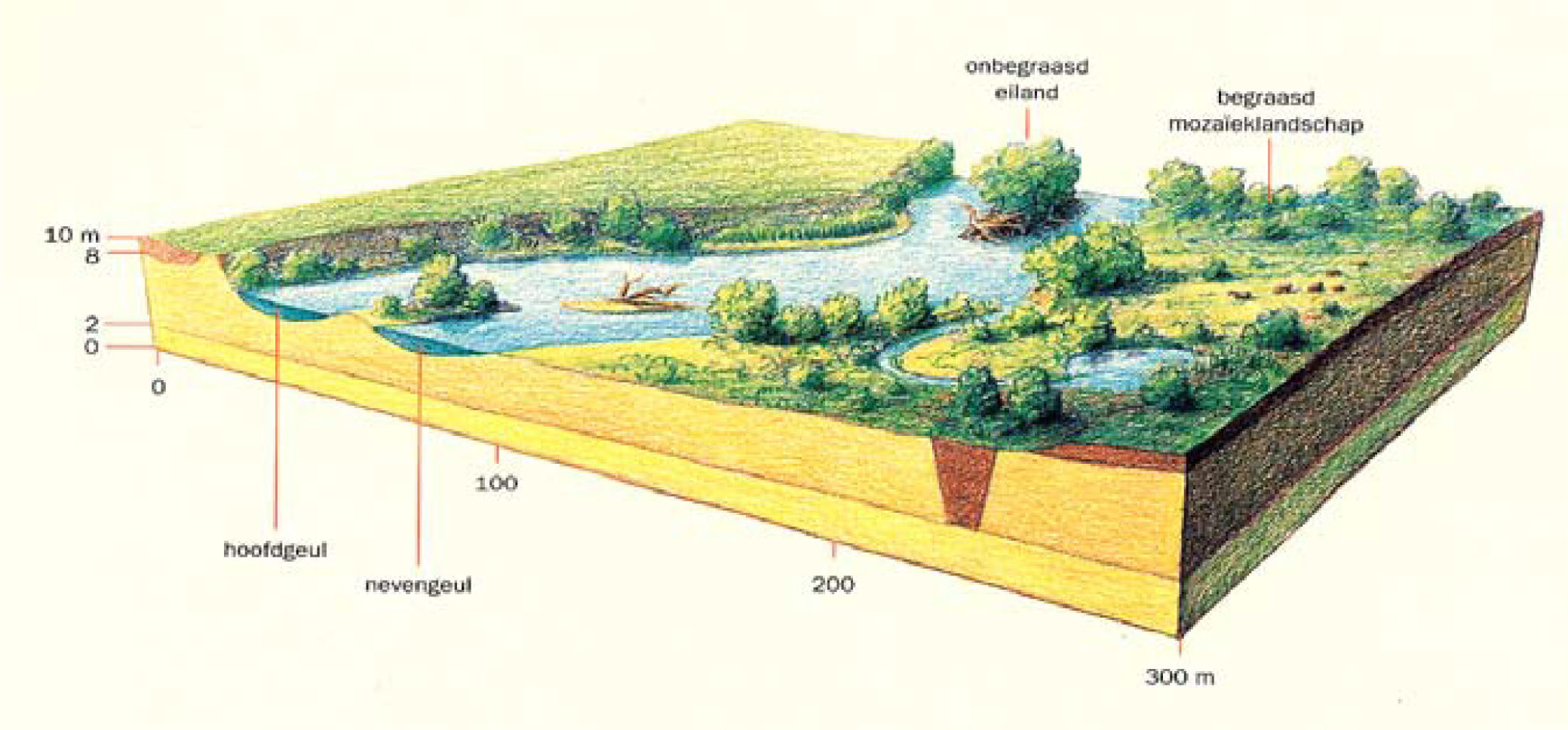
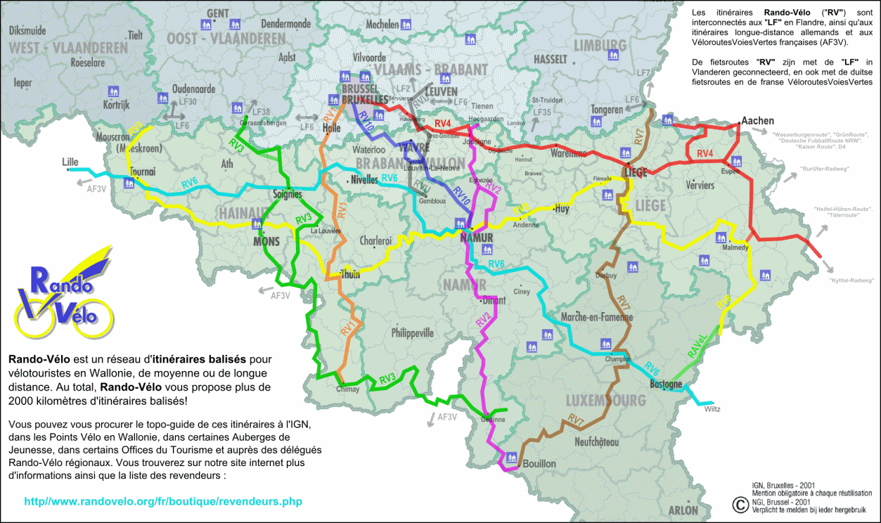
FUTURE MEUSE ?

THE GRENSMAAS PROJEKT: ROOM FOR THE RIVER

THE PLAN:

•  Widing the maas -> more room for the river
•  Affront of the dike
•  Deepen the coast
•  Reallocation from around 100 million barrel ground
•  Apply of gravel barriers
•  River is able to collect more water, dikeoutland  becomes wided-Riverline dams get applied to convey faster the water and to strengthen the coast
•  Removing the groinfields
•  Meandering of the channel
•  Heightening of the minimal outward flow
•  Development of vegetation in the outback

Plakat Grensmaas_englisch-1

Today’s state

before grensmaas

After grindwinning

after grensmaas

Future state

futur grensmaas

POST INDUSTRIAL MEUSE

LOCAL, REGIONAL IDENTITY

Der Stopfen von Lanaye (s.17)

Source: Europäisches Komitee für den Ausbau der Maas und die Verbindung maas-rhein (1956): die Maas und ihre Bedeutung fur den westeuropaischen Raum

defekter link

Umschlagort der Montanindustrie bei Lüttich (s.19)

Source: Europäisches Komitee für den Ausbau der Maas und die Verbindung maas-rhein (1956): die Maas und ihre Bedeutung fur den westeuropaischen Raum

Der Stopfen von Lanaye

industry in luttich

Source: Harald Finster: stahlart

defekter link industriebau lüttich


BEAUTY MEUSE

LOCAL, REGIONAL IDENTITY

Andreas Schelfhout – een bevroren Vaart bij de Maas, 1867

OLYMPUS DIGITAL CAMERA

Johan Conrad Greive – Schafttjid op een Scheepstimmerwerf aan de Maas, 1867

Johan Conrad Greive - Schafttijd op een scheepstimmerwerf aan de Maas, 1867

Andreas Schelfhout – een bevroren Vaart bij de Maas, 1867

Jan van Goyen - De Maas bij Dordrecht met de Groote Kerk, 1647

Hans van der Vloed – afgedamde Maas bij Woudrichem, 2012

Hans van der Vloed - Afgedamde Maas bij Woudrichem, 2012

Andreas Schelfhout – een bevroren Vaart bij de Maas, 1867

opnamedatum: 2003-03-10

EXCAVATION + EXPLOITATION: BELGIUM

GEOGRAPHY

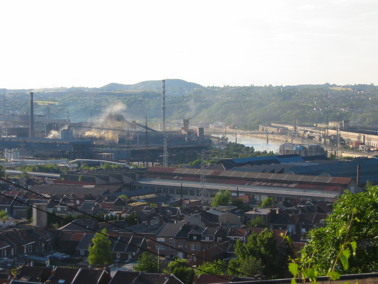
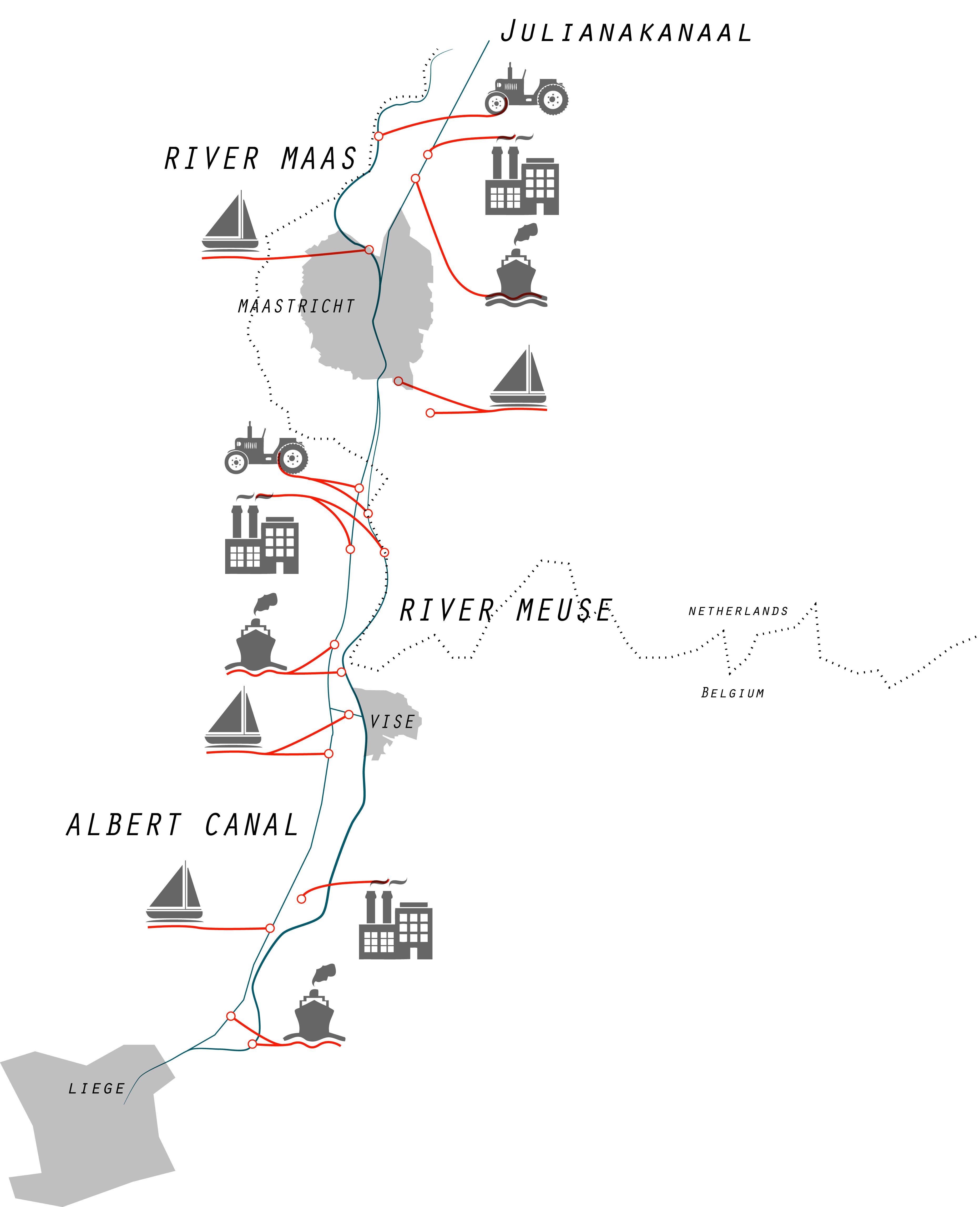
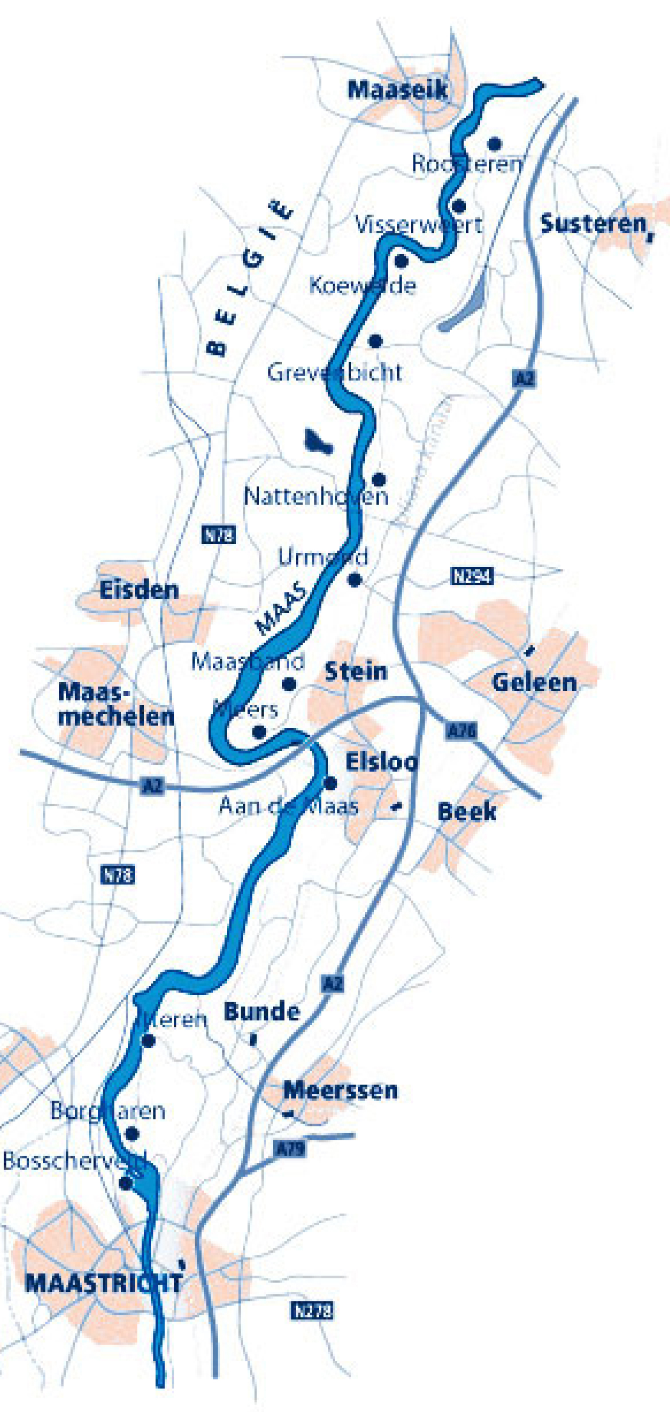
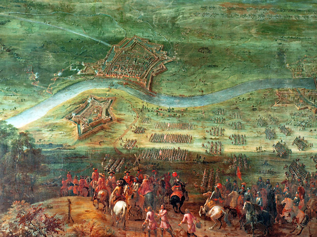
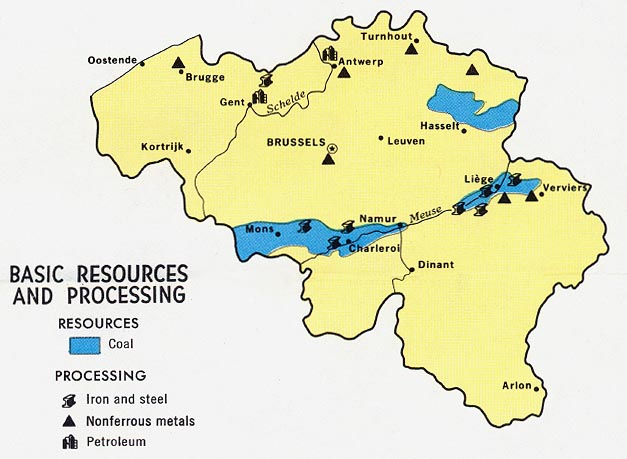
The sillon industriel (French for “industrial valley”) is the former industrial backbone of Belgium. It runs across Wallonia (Belgium’s Southern state) passing from Dour, in Borinage, in the west, to Verviers in the east, through Mons, La Louvière, Charleroi, Namur, Huy, and Liège, following the valleys of the rivers Haine, Sambre, Meuse and Vesdre, and has an area of roughly 1000 km².

It is also known as the Sambre and Meuse valley, as those are the main rivers, or the Haine-Sambre-Meuse-Vesdre valley, which includes two smaller rivers.

Belgium_resources_1968

It is less defined by physical geography, and is more a description of human geography and resources. As heavy industry is no longer the prevailing feature of the Belgian economy, it is now more common to refer to the area as the former industrial belt.


POPULATION + ECONOMY

Around two-thirds of the population of Wallonia (Belgium’s southern state) lives in the area – over two million people. Its main stretch is sometimes called the Charleroi-Liège valley, which connects Charleroi and Liège. Some see it as a Walloon metropolis, albeit much more linear and less centralized than most.

The sillon industriel (located in Wallonia-Belgium’s southern state) was the first fully industrialized area in continental Europe. Its industry brought much wealth to Belgium, and it was the economic core of the country. This continued until after World War II, when the importance of Belgian steel, coal and industry began to diminish. The region’s economy shifted towards extraction of non-metallic raw materials such as glass and soda, which lasted until the 1970s. The days of prosperity were gone, however, and a trend of unemployment and economic dependence on the formerly poorer Flemish Region (Belgium’s northern state) began, and continues to this day.

The region has seen numerous general strikes, some with social aims, some with political aims. In 1886, due to economic crisis, lowering of salaries and unemployment; in 1893, 1902 and 1913, as a struggle for universal suffrage. More strikes occurred in
1932 and 1936, with a strike in 1950 on the question of the return of Leopold III to the Belgian throne. The region was at the heart of the general strike of winter 1960-1961, which helped Wallonia to gain autonomy.

CHANNEL ALBERT

SHIPPING NAVIGATION LOCKS

THE CHALLENGE:
The Albert Kanaal runs from the inland port of Liege to the port of Antwerp and is fed entirely by the Meuse. The total fall is 55.5 meters. Inland navigation accounts for the transport of about 40 million tons per year.  The canal relies on tapping the water of the Meuse and competes in low flow with other purposes (irrigation, drinking water production, nature), as well as a migration bypass for many fish species.

The necessary discharge of 25 m3/s is easily met for most of the year, as the average Meuse discharge is about 200-250 m3/s. In dry periods of several weeks, however, the Meuse discharges can drop below 50 m3/s. Based on the Meuse Dischrage Treaty, Flanders (northern Belgium) and the Netherlands divide the available water during droughts – sometimes leading to a lack of water for the Albert canal. Climate change may cause a more frequent occurence of low Meuse discharges.

Zentralblatt der Bauverwaltung : Nachrichten d. Reichs- u. Staat
THE PLAN:
Pumps will be installed on the Lock of Ham as a pilot case. They will have a capacity of 15 3/s. They are designing in a fish-friendly way. In periods with sufficient discharge of the meuse these pumps will work in reverse direction as a hydro electric power station. The large fall at the lock (10m) can produce green electricity for about 1000 inhabitants and contribute to the production of renewable energy.

CHANNEL MEUSE

EXCAVATION + EXPLOITATION:
TRANSNATIONAL

3_project_image


trilogiport-02fehlender link

The primary aim of Liège Trilogiport is to offer a home to European distribution centres in direct contact with the container terminal located along the Albert Canal. It will provide access to road and rail-networks in the region.Businesses setting up shop there are located on the logistical warehouses site, in the immediate vicinity of the Albert Canal, which connects Liège to Antwerp (14 h navigation) and Rotterdam (24h navigation).
Liège Trilogiport is strategically situated for connectivity. It is located upstream from four major North Sea ports (Antwerp, Zeebrugge, Rotterdam and Dunkirk) and in the midst of a market boasting 56 million consumers.

HYDROLOGICAL CONTEXT

REGIONAL SCALE

site context_3LP map WATER-sc150000

The following highlights the programmatic difference between River Maas, NL and River Meuse, BE.

Canal v River_Programming Diagram

In Belgium, the river and the parallel Albert Kanaal both serve for navigation.
In Netherlands the river has been freed from shipping by the GrensMaas project and its partnering Julliana Kanaal  accommodates navigation.
Could the Belgium Meuse be freed from shipping and the canals accommodating shipping continuously across the border?